


 Unboxed")
")


Hyderabad IT professional Spots MH370 in Satellite Images

Several days and several searches later, when many countries came up empty in their search for the MH370, Malaysian Airlines flight which went missing about 10 days ago, A Hyderabad based software techie may have found possibly the most vital clue in finding this aircraft. Anoop Madhav Yeggina, an IT professional working with a software company in Hyderabad, Andhra Pradesh, uploaded a satellite image and claimed it was the image of the missing flight. While searching images of DigitalGlobe Satellite QB02, Anoop had found a satellite image of a large aircraft flying very low above the Andaman Islands on March 8.
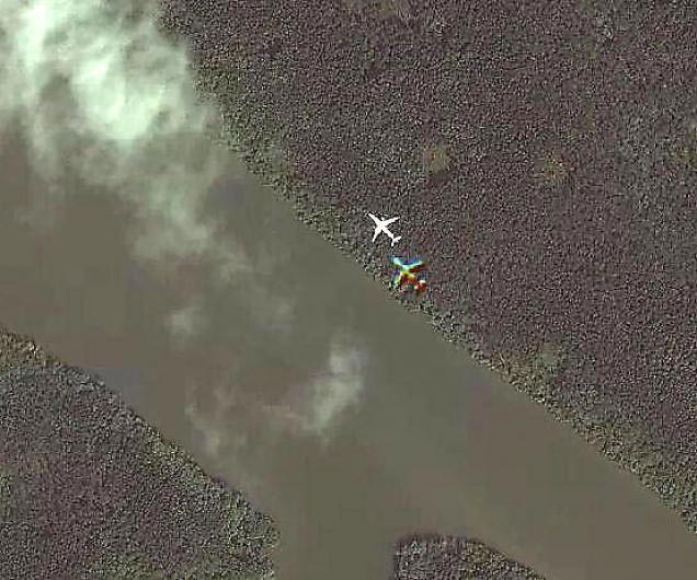
[quote text_size=”small” author=”Anoop Madhav Yeggina”]I am confident that the image is that of the missing plane because of many reasons. First giveaway is the fact that the image was captured just above a forest and very close to the Shibpur air strip of Andaman Islands.The air strip is exclusively used by the defence forces with no permission for civilian aircraft in this area. A close look at the image will reveal if it is flying extremely low so much so that the clouds are above it which suggests it was done to avoid detection by radar. Most importantly, the standard scale measurement and colour of the missing plane matches with that of the plane in the image[/quote]
According to Anoop, the aircraft matches the dimensions of the missing airliner and also the colour. The area in which the image was taken, is meant for Defence Aircraft so a commercial airliner in this area could mean that there is a high possibility of a highjack. Considering it has been 10 days, there is no possible way the Aircraft could remain in the air without refuelling. Lots of outcomes of the current scenario can be had including a large possibility of the image being incorrect.
Update :
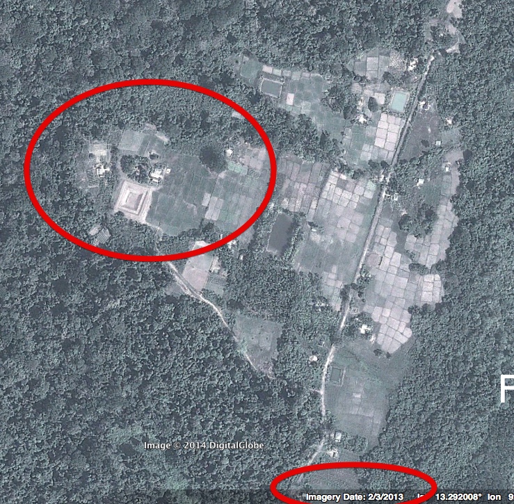
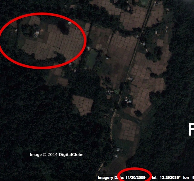
It has since been verified that the image of the aircraft is actually a dated image, where the fields around the aircraft in the image match an old stock image from as old as 2009 and are significantly different in the present version, at Coordinates:13.29431,92.99277.