


 Unboxed")
")


Google Maps Auto Rickshaw Will Calculate Time And Price Of The Ride

Google has been rolling out country specific features for a long time and it’s Maps feature is one of the best navigation tools in the world. While there are many India-specific features already available, a new feature that has been recently introduced can be extremely helpful for a lot of residents as well as travellers. The new feature allows you to see how long it will take to reach your destination in an auto rickshaw. It also shows the estimated cost for the travel. Indian auto rickshaws are infamous for not using their fare meter and overcharging. Many rickshaws use the fare meter and take tourists around a longer route to get an inflated fare. So we checked out the new feature on Google Maps and it is pretty cool! See how it works:
First thing is to check if the Maps app is up-to-date or not. Then open the app and select the location you wish to visit.
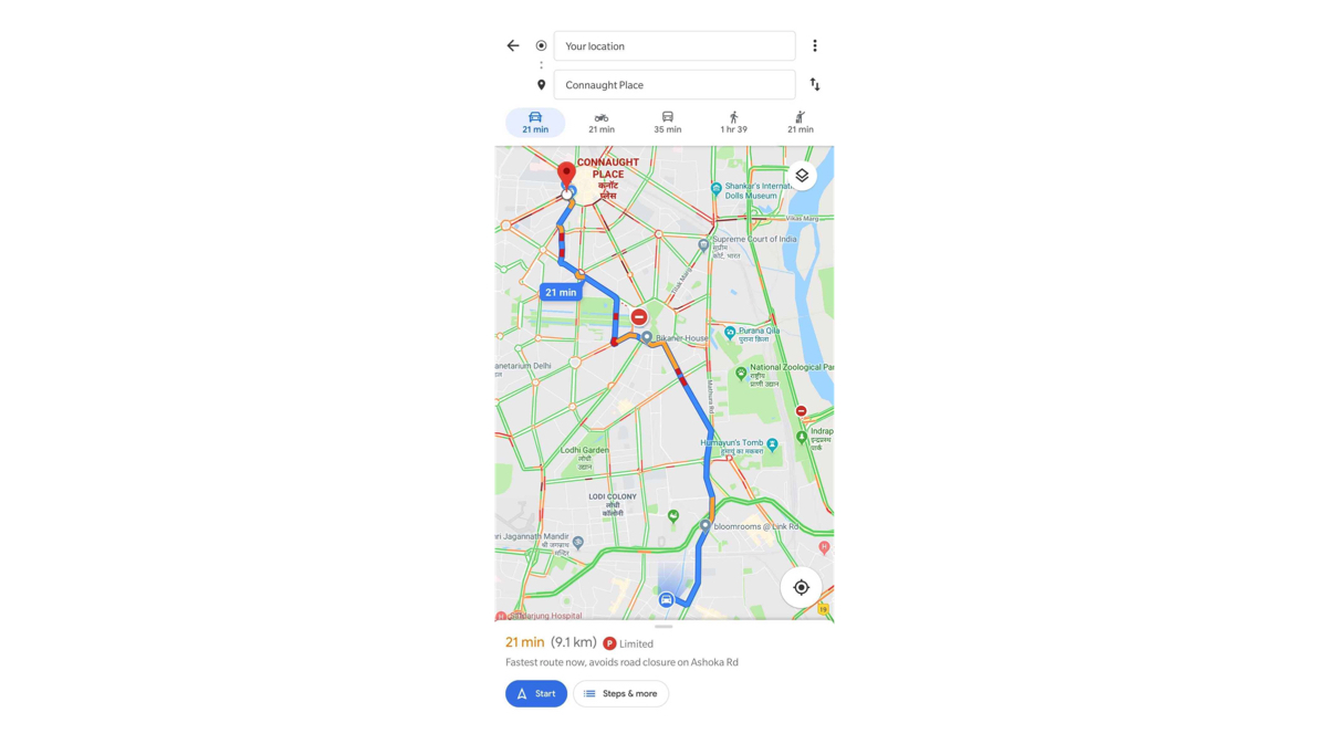
Second step is to select the mode of transport. Since the default is always a car or four wheeler, select the ‘Public transport’ section. This looks like a Train symbol which is on the right of the ‘Bike’.
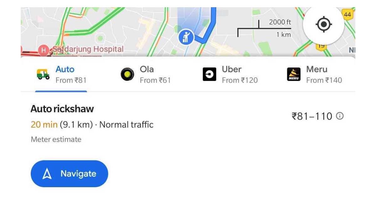
Scroll to the bottom half of the screen on Google Maps and you will see an ‘Auto’ option in the ‘Other Options’ section. It shows the approximate cost and time taken for the journey.
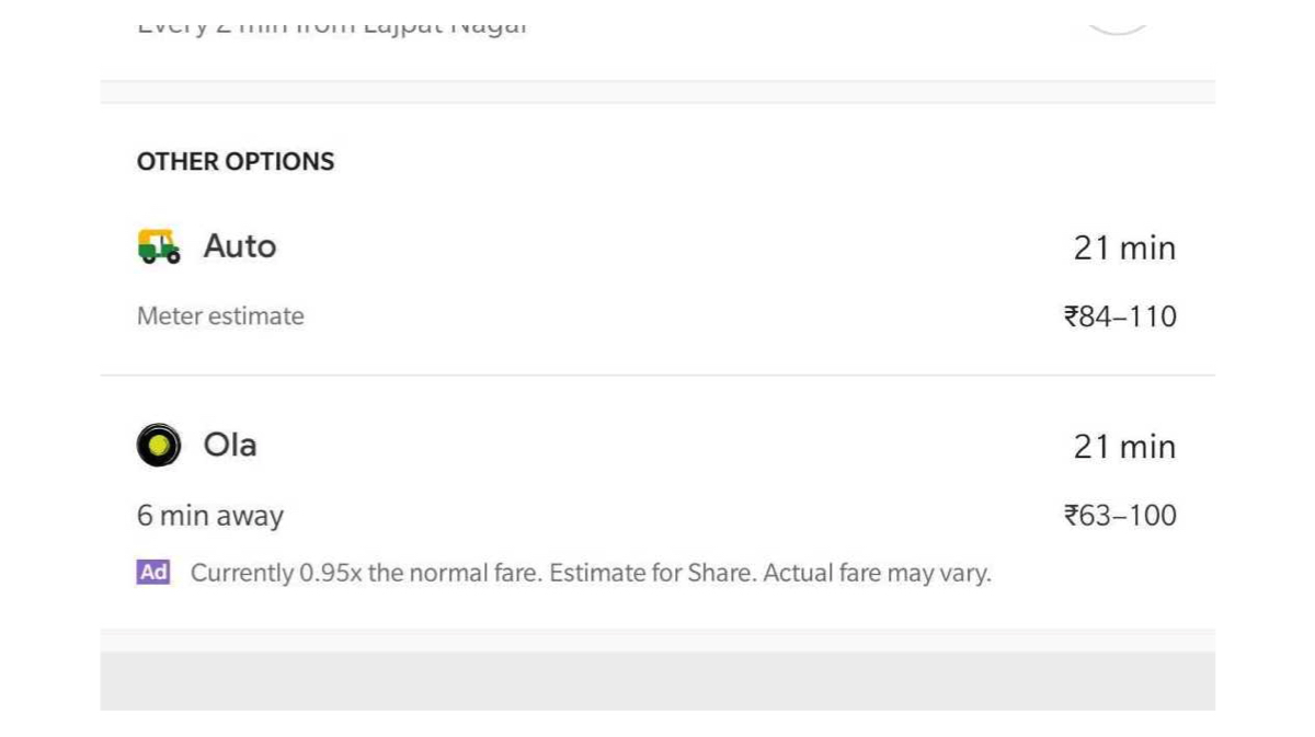
You can also find different options for Taxi aggregators such as Ola, Uber and Meru cabs which show the estimated cost and allow you to directly jump to the respective apps for booking.
While the Auto feature in Google Maps is currently available in Delhi, the country’s capital, we hope Google rolls the feature out to other cities soon.